 This is Blackhead Mountain in the Catskills, from a lookout on Black Dome, and somewhere in the middle is the trail that links the two. If I can figure out the scale of the photo, and the direction that the camera is pointing, I can use my GPS log to draw the trail.
I know the GPS position of the Blackhead peak and the camera, and using those I can calculate the distance and bearing between the two. But since the peak is off center, I need to figure out the direction the camera was pointing, even though it's only off by a few degrees.
The peak is offset by 114 pixels horizontally (the black triangle). If I can figure out the scale of the photograph accurately, I can use this to figure out angle the camera is pointing. Of course, the original image is much larger, but the ratios should stay the same.
If I can figure out the scale and rotation of the image, I should be able to line up the GPS log of the trail with the picture...
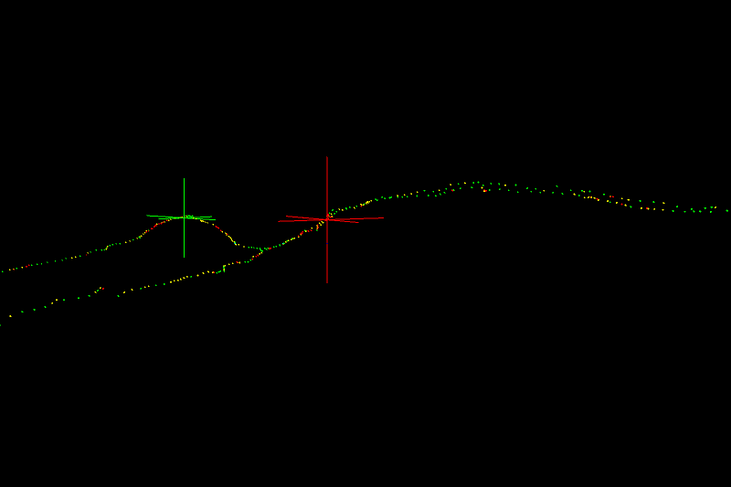
This is a crudely oriented view of the GPS trail. The red cross is the camera position, and the green cross is the peak of Blackhead. So all I really need to do is line up those two points over the picture... simple enough, right?

Ultimately it should look something like this, but with more picture and less black void...
No comments:
Post a Comment